Lanayru Wetlands
| This article is a stub. You can help the Zelda Dungeon Wiki by expanding it. |
"These extensive wetlands cover a broad plain to the southwest of Zora's Domain. There are several islands throughout the shallow lake that are connected with crude bridges. There are the remains of a ruined village on the large island in the middle of the wetlands."

Map of the Lanayru Wetlands in Breath of the Wild
Games | ||
Location | ||
Points of | ||
The Lanayru Wetlands is a location found in Breath of the Wild, Age of Calamity, and Tears of the Kingdom.
It is a district, largely formed by moorland, in the westernmost part of Lanayru province, which both major rivers from Lanayru Great Spring flow into. It contains one the largest bodies of freshwater in Hyrule in terms of area, similar on size to Lake Hylia but considerably shallower, as ~70% of said area is just knee-deep.
The Wetlands constitute the western entrance to the Zora Domain from Central Hyrule, and are bordered by the Hylia River to the west, Crenel Peak to the north-west, Zelo Pond to the north, Inogo Bridge over the Zora River to the north-east, the Rutala River to the east, Quatta's Shelf & Telta Lake to the south, and Nabi Lake to the south-west.
The Wetlands may well be among the first locations where Link may encounter Lizalfos on dry land, as the ones swimming in the river between the Dueling Peaks further south may not alert Link with their presence unless they're first engaged in combat. Also, despite being located in Lanayru, the Wetlands are not plagued with the constant rain of the Zora Domain, courtesy of Vah Ruta.
Locations
Breath of the Wild
- Bannan Island
- Boné Pond
- Goponga Island
- Goponga Village Ruins
- Kincean Island
- Lanayru Tower
- Linebeck Island
- Mercay Island
- Millennio Sandbar
- Molida Island
- Moor Garrison Ruins
- Rikoka Hills
- Shrine Island
- Wes Island
- Wetland Stable
- Zauz Island
Shrines
Age of Calamity
Tears of the Kingdom
The Lanayru Wetlands is a massive wet area found well west of Zora's Domain. The Wetlands are where the Zora River and Rutela River both spill into, as well as where the Hylia Rive begins to flow. To the southwest, the Millennio Sandbar is filled with shallow water, along with numerous smaller islands.
The paved pathway southeast of Wetland Stable heads into the Lanayru Wetlands, traveling across the Millennio Sandbar on a series of fragile wooden bridges. The pathway connects all the way to the northeast, connecting with the pathway that leads east along Zora River. The bridges also diverge and travel eastward across the Boné Pond, up the cliffside.
Treasure Chests
- Soldier's Bow - Just west of Boné Pond, in a wooden chest floating in the water.
- Large Zonai Charge - Just west of Boné Pond, found on top of the Zonai Ruins.
- Strengthened Lizal Bow - Northwest of Boné Pond, within a camp of Lizalfos and Bokoblin.
- Arrow x10 - Floating in the water just east of Mercay Island.
Gallery
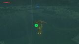
Link paragliding over the Wetlands
